Germany’s LUITA Project. The Fire Brigade’s Fastest Vehicle May Soon Be a Drone
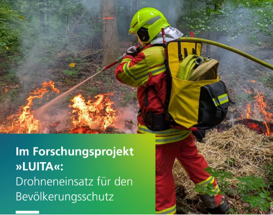
When firefighters are called to a vegetation fire, they often begin with one critical problem: they do not know exactly where the fire is.
There may be no street address. The terrain may be difficult to access. Witnesses may report smoke from several kilometres away without being able to identify its source. Meanwhile, every lost minute gives the flames more time to spread.
Germany’s new LUITA research project wants to change that.
LUITA stands for “Airborne Interdisciplinary Tactical Reconnaissance.” The project is examining how remotely operated drones can deliver live aerial intelligence to emergency control centres and incident commanders before fire crews even arrive at the scene.
Its ambition is striking: centrally controlled drones should be able to launch within 30 seconds of an alarm and begin transmitting high-resolution live images.
That could fundamentally change the first phase of wildfire response.
Instead of driving toward an unclear situation with limited information, dispatchers and fire officers could already see the location, size and possible direction of the fire. They could identify access routes, threatened infrastructure and difficult terrain while emergency vehicles are still on the road.
This would allow resources to be deployed more precisely.
A small fire might be contained faster. Additional crews, water carriers or specialist equipment could be called earlier. Dangerous routes could be avoided. Decisions that currently happen after arrival could begin several minutes sooner.
In wildfire response, those minutes can be decisive.
The project is coordinated by the Institute of Human Factors and Technology Management at the University of Stuttgart, working closely with Fraunhofer IAO and the districts of Reutlingen and Zollernalbkreis.
The two districts are contributing operational expertise, building drone-port infrastructure and testing the systems under realistic conditions. The research partners are developing operational scenarios, response plans, training programmes and evaluation methods.
This is important because LUITA is not simply a drone-development project.
The technology already exists to place a camera in the sky. The harder task is integrating that camera into the complex structure of emergency response.
Drone data must reach the right people quickly. Control-room staff must know how to interpret it. Incident commanders need clear procedures for using it in tactical decisions. Firefighters on the ground must understand how the drone supports their mission without creating confusion or additional workload.
As researcher Lena Posselt explains, the success of the system depends not only on technology, but also on organisation, communication and tactical decision-making.
That is why real and documented test deployments are central to the project.
Researchers will measure launch and flight times, the quality of live images, the stability of data links and the communication between control rooms, command teams and crews at the scene.
They will also examine some of the most difficult legal and operational questions surrounding emergency drones.
Can the aircraft operate beyond the visual line of sight? How quickly can airspace clearance be obtained? How will collisions with helicopters or other aircraft be prevented? What happens if communications fail?
These are not minor details. A drone that cannot launch quickly, maintain a reliable connection or integrate safely with other aircraft will provide little value during a real emergency.
LUITA’s long-term goal is therefore broader than helping two German districts.
The project aims to create a practical blueprint that other regions can adopt. Its findings are expected to include guidelines, operational recommendations, training materials and transferable models for the safe use of drones in civil protection.
Future developments could also combine live aerial images with artificial intelligence.
AI-supported systems might help identify smoke, map fire boundaries, detect heat sources or estimate the likely direction of spread. However, LUITA’s focus on human workflows is crucial. Artificial intelligence is useful only when its outputs are trusted, understandable and integrated into real command structures.
The project officially began on June 1, 2026, and is being supported through Germany’s DATIpilot funding programme.
Its success could reshape how emergency services approach vegetation fires and other complex incidents.
The first vehicle to reach the scene may no longer be a fire engine.
It may be a drone already circling above the flames, giving responders the information they need before they see the smoke themselves.