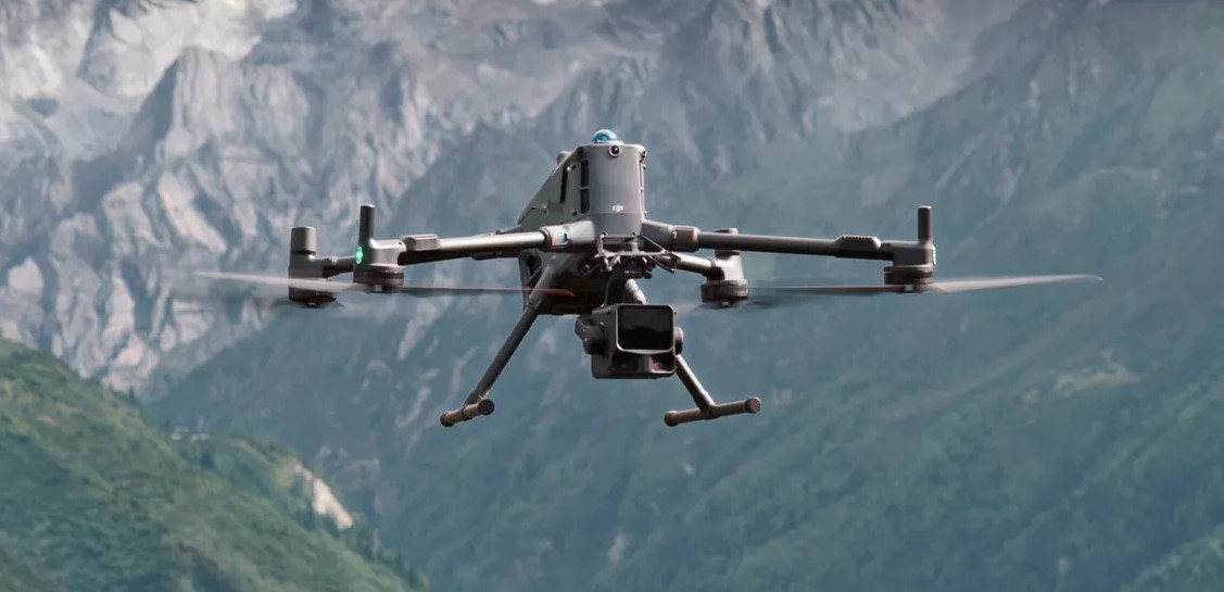
YellowScan Voyager - Expanding the Frontiers of Airborne LiDAR Mapping
.jpg)
In the ever-evolving world of aerial mapping, precision, flexibility, and efficiency are the benchmarks that define success. The YellowScan Voyager—the flagship long-range LiDAR system from YellowScan—has been engineered to deliver all three in a single, compact, and reliable platform.
Built for professionals who demand accuracy at scale, Voyager empowers survey teams to capture precise geospatial data over vast terrains and challenging environments — whether operating from a drone, helicopter, or manned aircraft.
As organizations seek faster, more scalable survey solutions, Voyager stands out as a transformative technology for corridor mapping, wide-area surveys, and time-critical missions.
Precision at Altitude
At the core of the YellowScan Voyager is its high-altitude performance. Designed to operate effectively at 400 feet and higher, Voyager allows crews to cover larger areas per flight while maintaining survey-grade precision.
Unlike traditional low-altitude LiDAR systems, which require multiple passes and frequent recharging, Voyager captures consistent, high-density point clouds from greater altitudes — minimizing flight time and maximizing operational efficiency.
For industries such as infrastructure management, forestry, mining, and utilities, this means faster project turnaround without sacrificing accuracy.
Engineered for Efficiency and Scale
YellowScan developed Voyager with a clear goal: to optimize airborne LiDAR performance for both UAVs and manned platforms. The system combines a powerful laser scanner with integrated GNSS/INS positioning, ensuring centimeter-level accuracy even at high altitudes or across complex terrain.
This capability enables survey teams to map long linear corridors — such as roads, pipelines, and power lines — in fewer passes and with consistent data integrity. The system’s wide field of view and long-range detection make it ideal for capturing both macro topographies and micro details in a single flight.
Voyager’s efficiency also shines in large-area mapping. Covering extensive regions in a fraction of the time compared to conventional methods, it reduces not only flight duration but also post-processing workloads — a critical factor in time-sensitive projects.
Versatility Across Platforms: From Drones to Helicopters
One of Voyager’s most compelling features is its mounting versatility. While optimized for high-end UAVs, it can also be installed on helicopters and other crewed aircraft, offering unmatched operational flexibility.
This adaptability opens the door for organizations to deploy the same high-precision LiDAR technology across different mission scales — from drone-based localized mapping to wide-area manned flights covering hundreds of square kilometers.
For example, survey teams can use drones for detailed inspections of smaller sites and seamlessly transition to helicopter-mounted Voyager systems for expansive regional mapping — all within the same workflow and software environment.
This interoperability eliminates the need for multiple hardware solutions, streamlining logistics and standardizing data formats across mission types.
High-Density, High-Fidelity Data
The YellowScan Voyager delivers dense, accurate, and clean point clouds with minimal noise, even at higher altitudes. Its advanced scanning technology ensures consistent data capture across varying reflectivity surfaces, from vegetation canopies to urban structures and open terrain.
When paired with YellowScan’s intuitive software suite, operators can visualize, process, and classify point clouds with remarkable ease, accelerating the path from raw data to actionable insights.
Whether you’re creating digital terrain models (DTMs), digital surface models (DSMs), or high-resolution 3D reconstructions, Voyager’s output ensures data integrity for downstream applications in GIS, engineering, and environmental analysis.
Streamlined Workflows and Reduced Downtime
YellowScan designed Voyager not only for data quality but also for operational simplicity. Its lightweight, compact form factor allows quick integration onto multiple aircraft types, while its plug-and-play configuration minimizes setup time.
With its extended range and endurance, teams can conduct longer missions with fewer battery swaps or refueling cycles — reducing overall downtime and boosting mission efficiency.
Combined with YellowScan’s real-time monitoring tools, operators gain a clear overview of coverage, altitude, and point density during flight — ensuring quality assurance before the aircraft even lands.
Empowering Crews for Real-World Challenges
From environmental monitoring to infrastructure inspection, coastal mapping, and emergency response, Voyager equips crews to handle diverse operational demands. Its helicopter-mountable capability is particularly valuable for projects in rugged or remote areas where UAV operations may be limited by range or regulation.
As industries push the boundaries of aerial data acquisition, Voyager enables teams to maximize efficiency, reduce costs, and expand mission capabilities — without compromising precision or reliability.
Conclusion
The YellowScan Voyager is more than a LiDAR payload — it’s a bridge between drone and manned operations, uniting accuracy, scale, and adaptability in one system.
By combining high-altitude performance with multi-platform versatility, Voyager empowers geospatial professionals to rethink how they approach large-scale mapping and time-critical projects.
For those ready to take airborne LiDAR to new heights — quite literally — the YellowScan Voyager is not just a tool but a technological leap forward in precision mapping.


