DroneNews24 at Intergeo 2025 - Exploring the Future of Geospatial Innovation
.png)
Today, I had the privilege of attending Intergeo 2025 in Frankfurt, one of the world’s leading trade fairs for geodesy, geoinformation, and land management. The event once again proved why it remains a vital hub for professionals in the drone, mapping, and surveying industries. With technology rapidly reshaping how we capture and understand our world, Intergeo 2025 was a vibrant showcase of innovation, collaboration, and emerging opportunities.
From the moment the exhibition halls opened, the atmosphere buzzed with energy. Thousands of visitors gathered around interactive booths, demonstrations, and live product unveilings. For DroneNews24, it was an invaluable opportunity to connect with industry leaders and explore the trends shaping the next generation of drone-based geospatial solutions.
One of the key highlights of my visit was meeting with CHCNAV, a global leader in precision positioning solutions. Their latest developments in GNSS receivers and LiDAR mapping systems emphasize accuracy, efficiency, and user experience. CHCNAV’s team shared insights on how their integrated systems are improving workflows in surveying, agriculture, and infrastructure monitoring. Their focus on interoperability and easy integration with various software platforms is clearly positioning them as a trusted partner for professionals seeking robust geospatial solutions.
Another fascinating encounter was with OrthoDrone, a company specializing in orthophoto generation and aerial mapping services. Their presentation on high-resolution imaging for urban planning and environmental monitoring demonstrated the growing importance of photogrammetry in data-driven decision-making. OrthoDrone’s advancements in cloud-based processing workflows also caught my attention—speeding up project delivery while maintaining exceptional accuracy.
Feima Robotics stood out for its industrial-grade UAVs designed for long endurance and complex mission profiles. The team introduced their new hybrid-powered drone, offering extended flight times and higher payload capacity—ideal for large-scale mapping and inspection tasks. Their commitment to combining hardware innovation with AI-driven automation highlights how robotics is becoming central to geospatial intelligence.
At the booth of Loopool.ai, the conversation shifted toward data analytics and artificial intelligence. Loopool.ai presented cutting-edge machine learning models that can automatically classify, interpret, and visualize geospatial data from aerial imagery. Their technology opens the door to faster insights, from detecting infrastructure defects to analyzing vegetation health. As AI continues to transform the industry, Loopool.ai’s solutions exemplify the shift from raw data collection to meaningful, actionable intelligence.
GDU Tech Drones presented a versatile range of modular drones that are redefining adaptability in the field. Their approach to modularity allows professionals to customize sensors and payloads for different missions, reducing downtime and maximizing ROI. GDU’s representatives emphasized their dedication to making professional drone technology more accessible and field-ready.
I also had the pleasure of visiting HySpex GmbH, a leader in hyperspectral imaging technology. Their sensors can capture hundreds of spectral bands simultaneously, offering powerful insights for environmental monitoring, precision agriculture, and mineral exploration. Their solutions demonstrate how the boundaries between Earth observation and spectral science are becoming increasingly blurred.
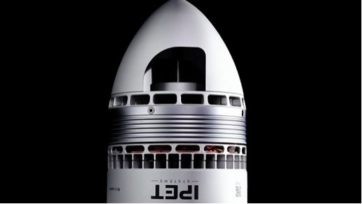
Seafloor Systems offered a refreshing dive—literally—into hydrographic survey technology. Their autonomous surface vehicles (ASVs) and sonar mapping systems expand the reach of data acquisition beneath the water’s surface. Their work is a crucial reminder that “mapping the world” includes both land and sea.
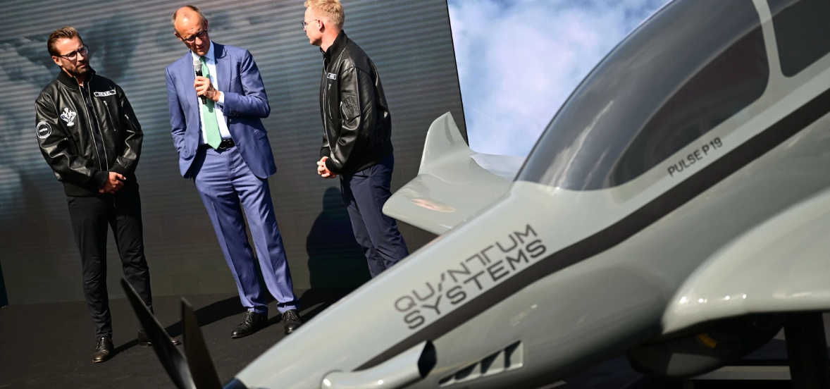
Among the more familiar names, Autel Robotics showcased their latest EVO series drones, blending high-performance imaging, compact design, and AI-assisted flight modes. Meanwhile, Sony presented its newest aerial imaging solutions, merging their renowned camera expertise with drone integration for cinema-quality mapping and inspection. Finally, Quantum Systems impressed with their hybrid fixed-wing drones, known for their long endurance and high-precision data collection—tools already making waves in both commercial and defense applications.
What stood out across all these encounters was the spirit of collaboration and convergence. The geospatial industry is no longer about isolated technologies—it’s about ecosystems that connect hardware, software, and data analytics into seamless workflows. Intergeo 2025 made that vision tangible.
As I left the halls of Messe Frankfurt, I felt energized by the pace of innovation and the shared commitment to shaping a smarter, more connected planet. DroneNews24 will continue to follow these developments closely, bringing our readers insights into the companies and technologies that are pushing the limits of aerial data collection.
Intergeo 2025 once again confirmed that the future of geospatial technology is airborne, intelligent, and more collaborative than ever.