Digitizing Alcatraz - How eBee X Flight from EagleNXT Helped Future‑Proof an American Icon

For more than a century, Alcatraz Island has stood as a symbol of isolation, power, and decay—etched into history by salt air, seismic forces, and myth. Now, in a quiet technological turn, the infamous prison has been reborn as a data-rich digital twin.
In late 2023, a multidisciplinary team led by Pete Kelsey of VCTO Labs completed one of the most ambitious heritage‑mapping projects ever attempted: a comprehensive, survey‑grade digitization of all 27 acres of Alcatraz Island—captured in a single flight using the eBee X fixed‑wing drone.
The objective was radical in its scope. Not just to map the prison’s exterior, but to create a unified, accurate digital record of the entire island—inside, outside, above and below—integrating photogrammetry, multispectral imagery, terrestrial laser scanning, SLAM, and drone‑based LiDAR. The result is a dataset so dense and precise it is expected to shape preservation, archaeology, biology, and operations for decades.
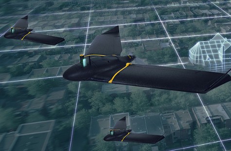
At the heart of the aerial work was the eBee X, equipped with the Duet M dual camera, capturing RGB and multispectral data simultaneously at a 2.29 cm / 0.90 in ground sampling distance. That efficiency mattered. Alcatraz is not a typical survey site—it is an active National Park, a protected wildlife habitat, and a tightly regulated airspace.
“Operations Over People changes everything,” said project lead pilot Bobby Valentine. “There aren’t many drones approved for that in the U.S. The eBee X was the right choice.”
With just two days allocated for aerial data capture, there was no margin for error. The flight plan had to account for uncharted obstacles—lighthouses, water towers, mature trees—and dynamic risks such as nesting seabirds and low‑flying Coast Guard helicopters. Visual observers were positioned across the island, and flight altitude was kept under 300 feet to avoid conflicts.
In one uninterrupted mission, the drone collected complete RGB and multispectral coverage of the island—without gaps, without re‑flights.
What makes this project exceptional is not just efficiency, but precision. Survey control, established by PCL Construction, delivered a 3‑millimeter absolute accuracy across the entire dataset—allowing data from competing technologies and vendors to align seamlessly. This level of coherence is what transforms raw scans into a functional digital twin.
The team spent three weeks on the island, at times sleeping inside former prison cells to maximize uptime. In addition to the eBee X, they deployed Boston Dynamics’ Spot robot, Flyability’s Elios 3 for confined interiors, Emesent’s Hovermap LiDAR for complex spaces, and high‑end RIEGL laser scanners.
The implications are profound. Multispectral analysis reveals vegetation health and subsurface anomalies invisible to the naked eye—crucial for archaeologists and biologists alike. Park managers can now prioritize structural repairs with millimeter accuracy. Future researchers can measure change over time, turning the dataset into a “temporal tracker” of decay, movement, and restoration.
Perhaps most striking is what didn’t happen: no wildlife disruption, no safety incidents, no missed data.
As Alcatraz continues to erode under wind, salt, and time, this dataset may one day outlast the stone itself.
“What’s unique,” Kelsey said, “is what this data can be used for—anything.”
For a place once designed to erase people from society, Alcatraz has now been preserved in unprecedented detail—captured not by guards or walls, but by quiet wings tracing the sky above history.