Revolutionizing Maritime Operations - Drone Carrier for GNSS-Denied Environments

In an age where drones have become vital for everything fromsearch and rescue to infrastructure inspection, there’s one domain that stillpresents a challenge: the vast expanse of the ocean. A key difficulty inmaritime operations is the unreliable or unavailable GPS signals. Inopen waters, especially in regions with poor satellite coverage or duringperiods of high interference, GPS signals can fail. This leads to significantissues for autonomous systems, which rely on GPS for navigation andpositioning.
However, a breakthrough technology is here to changethe game: the drone carrier system designed specifically for GNSS-deniedmaritime environments. This novel system introduces a new approach tomaritime inspections and interventions, offering greater flexibility,reliability, and autonomy in situations where traditional navigation systemsfail.
Developed by a consortium of maritime and tech experts, thisdrone carrier system is poised to transform the way we carry out taskssuch as offshore infrastructure inspections, environmental monitoring, andsearch-and-rescue missions.
What Makes GNSS-Denied Environments So Challenging?
The Global Navigation Satellite System (GNSS), whichincludes GPS, GLONASS, Galileo, and BeiDou, is integral to most modernnavigation systems. However, when it comes to maritime operations, there areseveral scenarios where GNSS is either unreliable or completely unavailable:
- High Latency or Signal Loss: In areas with poor satellite coverage (such as the poles or deep sea) or at times of high interference (e.g., during storms), GNSS signals may not be accessible.
- Signal Jamming or Spoofing: In high-stakes military or security environments, adversaries may intentionally jam or spoof satellite signals, rendering them useless for navigation.
- Remote Locations: Many maritime operations, like deep-sea exploration or offshore wind farm inspections, occur far from shore, where satellite signals become weak or absent.
These challenges make autonomous operations in maritimeenvironments particularly difficult, requiring innovative solutions forreliable navigation and task execution.
Introducing the Drone Carrier System
To overcome the limitations of GNSS, engineers havedeveloped a novel drone carrier system that serves as a platform for autonomousdrones in environments where GPS signals can’t be relied upon.
The system works by providing a stable base for unmannedaerial vehicles (UAVs) to launch, land, and operate without depending onGPS for orientation. Here’s how it works:
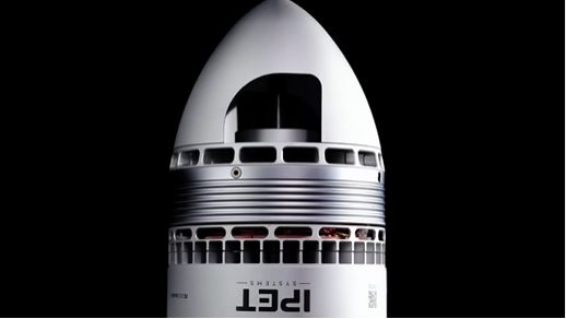
🚢 The Drone Carrier
At the heart of the system is a drone carrier, avessel designed to deploy and retrieve drones in rough maritime environments.Unlike traditional vessels or platforms, this carrier operates with minimalhuman intervention, allowing drones to carry out inspection, surveillance, andmaintenance tasks autonomously.
🛰 Innovative NavigationSystems
To overcome the GNSS challenge, the system employs a varietyof alternative navigation techniques:
- Inertial Navigation Systems (INS): These systems track the drone's movement based on internal sensors, allowing it to calculate its position relative to a starting point.
- Visual Odometry: The drones use onboard cameras and machine vision software to detect landmarks or ocean features, helping them navigate without external signals.
- Lidar and Sonar: In environments where visibility is poor, such as in underwater operations, drones can use lidar (light detection and ranging) and sonar for real-time positioning and obstacle avoidance.
- AI-Assisted Decision Making: The system’s AI algorithms analyze data from various sensors to make intelligent navigation decisions, adapting to changing environmental conditions in real-time.
🌊 Autonomous Operations
Once launched from the carrier, drones can carry out a widerange of tasks, such as:
- Inspecting offshore infrastructure, like oil rigs and wind farms
- Monitoring marine life and ecosystems
- Conducting search-and-rescue missions in challenging conditions
- Performing environmental monitoring, such as pollution tracking or water quality testing
By removing the need for constant human oversight, thesedrones are capable of executing complex tasks in high-risk or hard-to-reachareas with remarkable efficiency and safety.
Key Benefits of the Drone Carrier System
The introduction of the drone carrier system in GNSS-deniedenvironments offers several key advantages for maritime operations:
🛠 Increased Efficiency
By allowing drones to operate autonomously, the systemreduces the need for expensive, time-consuming manned operations, providingfaster and more accurate results.
🌍 Enhanced Reach andFlexibility
The system can operate in areas where traditional vesselsand crews would struggle, such as remote offshore locations, stormy seas, orregions where signal interference is common.
⚡ Reduced Risk to Human Life
Autonomous drones can handle hazardous tasks, reducing theneed for human workers to perform dangerous inspections or maintenance indifficult conditions, such as high seas or unstable platforms.
🌱 Sustainability
With drones powered by renewable energy sources and minimalfuel consumption, the system represents a more sustainable alternative totraditional maritime operations, reducing the environmental footprint of thesemissions.
Applications: A Game Changer for Maritime Industries
The potential applications of the drone carrier system arevast and varied. Here are some key sectors that stand to benefit:
⚙️ Offshore Oil and Gas
In the offshore oil and gas industry, drone carriers cansignificantly improve the efficiency and safety of inspections and maintenanceon oil rigs, pipelines, and other infrastructure. By performing these tasksautonomously, operators can reduce downtime, extend asset lifespan, and cutoperational costs.
🌬 Renewable Energy
For offshore wind farms, which are often located far fromshore, the drone carrier system can provide routine inspection and maintenanceservices, ensuring the turbines are running smoothly while avoiding the costsand risks associated with manned operations.
🆘 Search and Rescue
In emergency situations, such as shipwrecks or naturaldisasters, the drone carrier system can rapidly deploy drones to performsearch-and-rescue missions, mapping the area, locating survivors, and assistingrescue teams.
🌊 EnvironmentalMonitoring
Drones can also be used to monitor water quality, trackmarine pollution, and assess ecosystem health, providing critical data toenvironmental scientists and policymakers.
Challenges and Future Developments
While the drone carrier system holds immense promise, there are still challenges to overcome:
- Battery Life and Power Management: Ensuring drones can stay operational for long periods without recharging remains a key challenge, particularly in remote locations.
- Regulatory Compliance: As with any new technology, the system will need to meet regulatory standards for autonomous operations, particularly in international waters and heavily trafficked shipping lanes.
- Weather Conditions: Adverse weather conditions, such as storms or high winds, can impact drone performance, requiring further innovation in design and operational protocols.
However, as technology advances and demand for autonomousmaritime operations grows, the future of these drone carriers looks incrediblypromising.
Conclusion
The drone carrier system for GNSS-denied maritimeenvironments is a game-changer for industries that rely on offshoreinfrastructure and operations. By offering autonomous solutions to complextasks, this technology not only enhances safety and efficiency but also opensup new possibilities for sustainable and cost-effective maritime operations. Asthe system continues to evolve, it could very well define the future of how weinteract with and manage our oceans.
Short Summary (≤150 characters):
A novel drone carrier system enables autonomous maritime operations inGNSS-denied environments, transforming offshore inspections, rescue, andmonitoring.
%20(1).jpg)