Orthodrone - Pioneering High-Resolution Geospatial Solutions by Drone
Based in Kiel, Germany, Orthodrone GmbH is redefining the standards of aerial data acquisition. The company combines drone technology, sensor integration, and scientific expertise to deliver precise geospatial information for industrial and research applications around the globe.
From Startup Roots to Aerial Excellence
Founded in 2018 by geographers with a vision for innovation, Orthodrone set out to transform traditional aerial surveying. Their mission: replace costly, inflexible helicopter operations with agile drone systems that offer the same—or even higher—precision at a fraction of the cost.
Technical Edge: Hybrid Systems, Long Flight Times, and Full Integration
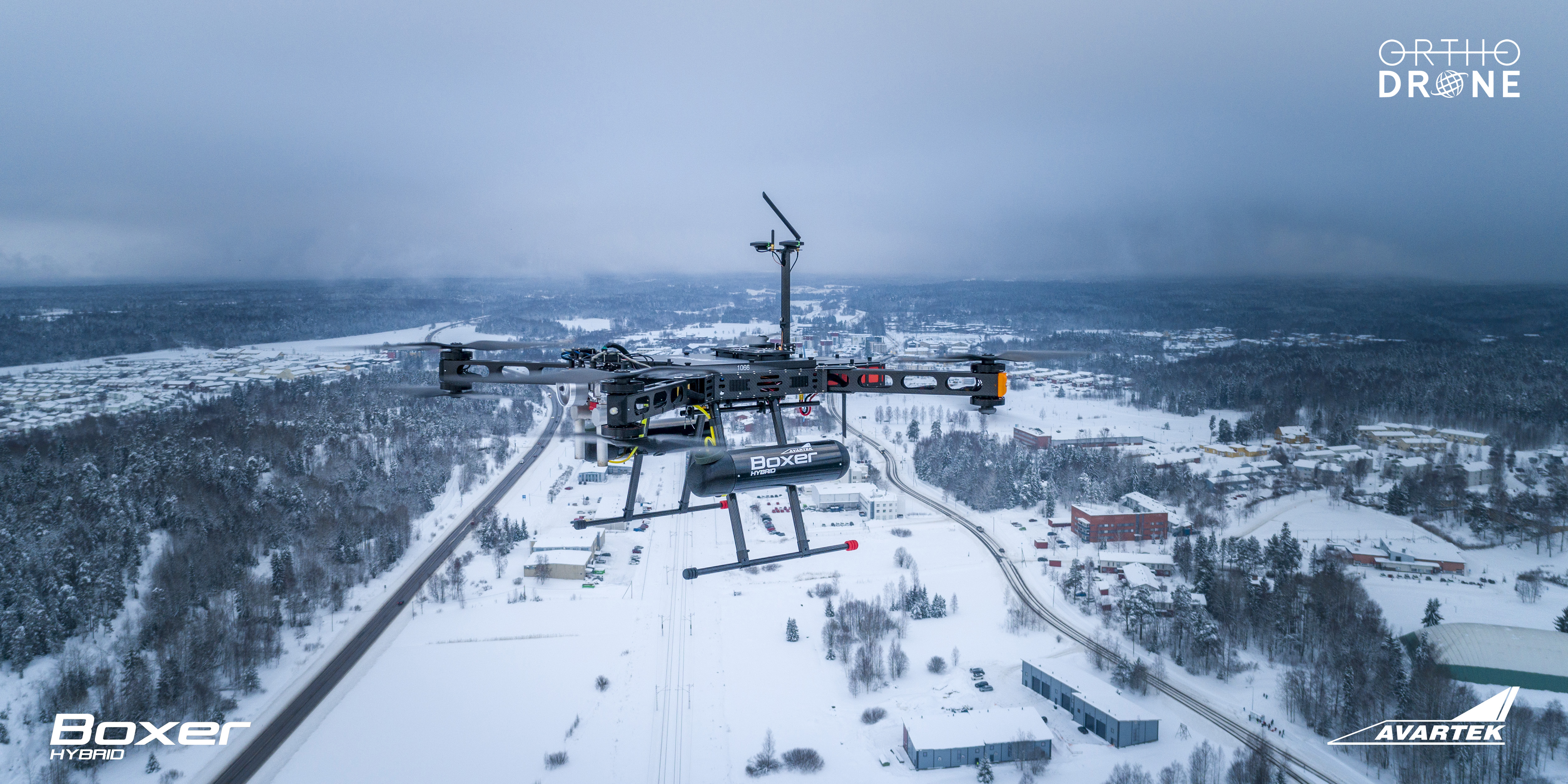
Orthodrone’s technological strength lies in the seamless integration of hybrid UAV systems, LiDAR, photogrammetry, and multispectral sensors. Each mission is tailored to customer requirements, enabling detailed mapping, volumetric analysis, and environmental assessment.
Their drone platforms are built for endurance, with long flight times and exceptional stability. By designing in-house control systems and sensor mounts, Orthodrone achieves unmatched precision, vibration control, and data reliability—without relying on standard off-the-shelf components.
Diverse Applications, Global Reach
Orthodrone operates across a wide range of sectors, including:
- Infrastructure and industrial inspection
- Coastal and floodplain mapping
- Environmental monitoring and research
- Challenging terrain surveys such as glaciers, wetlands, and forests
This versatility has made Orthodrone a trusted partner for both commercial clients and scientific institutions, combining technical excellence with a strong environmental commitment.
Engineering Independence and Innovation
The company emphasizes industrial sovereignty—developing its own hybrid platforms and mission control systems in Germany. This approach ensures flexibility, compliance with European standards, and the ability to adapt quickly to specialized project demands.
Looking Ahead
As industries increasingly depend on precise, real-time spatial data, Orthodrone’s approach to drone-based surveying represents the future of aerial intelligence. By merging innovation, reliability, and sustainability, the company is helping to shape a new era of geospatial insight—accurate, efficient, and ready for the challenges of a changing world.